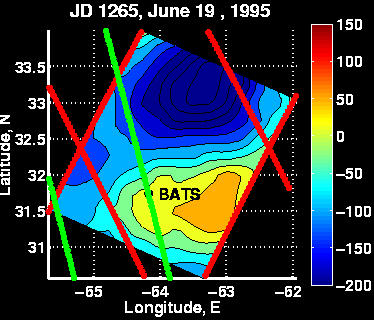
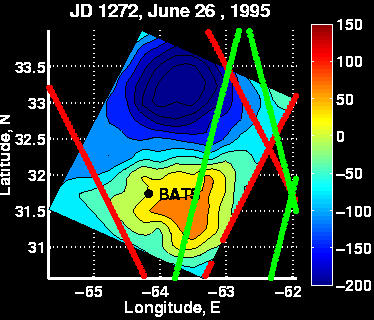
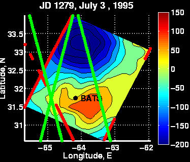
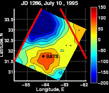
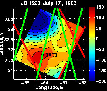
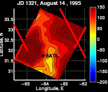
A time series of weekly sea level anomaly (SLA) maps has been
constructed for the period during which an eddy passed through
the BTM mooring location. Data from both Topex/Poseidon (T/P)
and
ERS-2 altimeters were included in the objective analysis. Ground
tracks for the former are shown in red, and the latter in green.
In interpreting these maps, it is important to realize that
data are available only along the ground tracks; the area in
between is spatio-temporal interpolation.
The objective analysis on July 17 clearly shows a positive sea
level anomaly over the mooring location. The feature is identified
by an ERS-2 track passing directly over the BATS site and a T/P
line to the southwest. The magnitude of the SLA is in the neighborhood
of 15cm, which is a factor of three to five above the noise floor of
the
altimetric measurements.
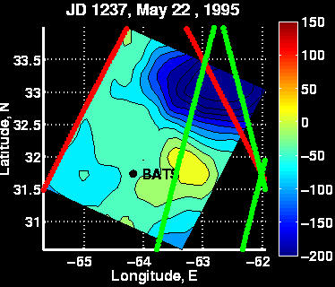
Examination of the time series leading up to the July 17 analysis
reveals that the eddy was first detected in this domain on May 22
by and ERS-2 overpass to the east of the BATS site. The feature
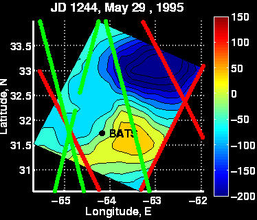
was again observed in the ERS-2 data on May 29, at which point
it appears to be on the brink of impinging on the BATS site.
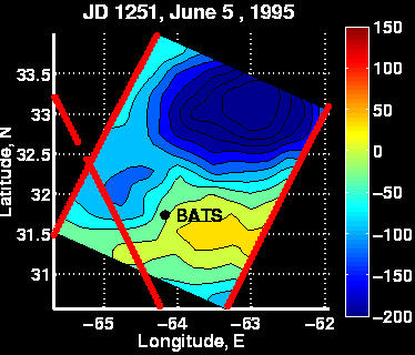
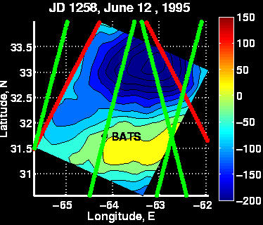
However, ERS-2 passes over BATS on June 12 and June 19 show this is
not
the case. It is possible that the eddy's westward propagation
was influenced by interaction with the negative anomaly to the north;
from these data it is not possible to say. The next overpass
of the
eddy does not occur again until June 26, when ERS-2 cuts across it
with an ascending pass. The subsequent descending pass in the
July 3 map defines the eastern extent of the feature, just barely
clipping the edge of the eddy. The eddy is not sampled again
until
the week of July 17, when it is directly over the mooring.
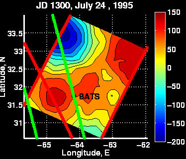
The exit of the feature from the BATS site can be seen in the
weeks following July 17. The eddy appears to be mostly past
BATS by July 24, when it is hit by a T/P line to the west and an ERS-2
overpass of BATS detects only the edge of the feature (if that).
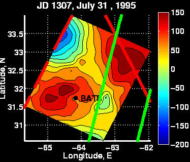
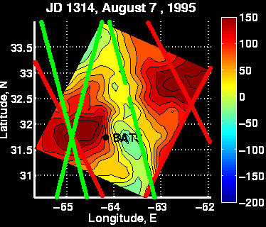
No ERS-2 data is available around the BATS site for another 35 days.
However, the feature is very clearly detected to the west again on
August 7
by one T/P two ERS-2 passes.
In summary, the timing of the arrival and departure of the feature
derived from the altimetric analysis is consistent with the mooring
observations. However, in making such a determination the vastly
different temporal resolutions of the mooring (minutes) and altimeters
(T/P - 10 days; ERS-2 - 35 days) must be taken into account.
Moreover,
it is absolutely essential to distinguish between observation and
interpolation in the interpretation of four dimensional objective
analysis.
Last Modified June 22, 1998
Dennis McGillicuddy
dmcgillicuddy@whoi.edu