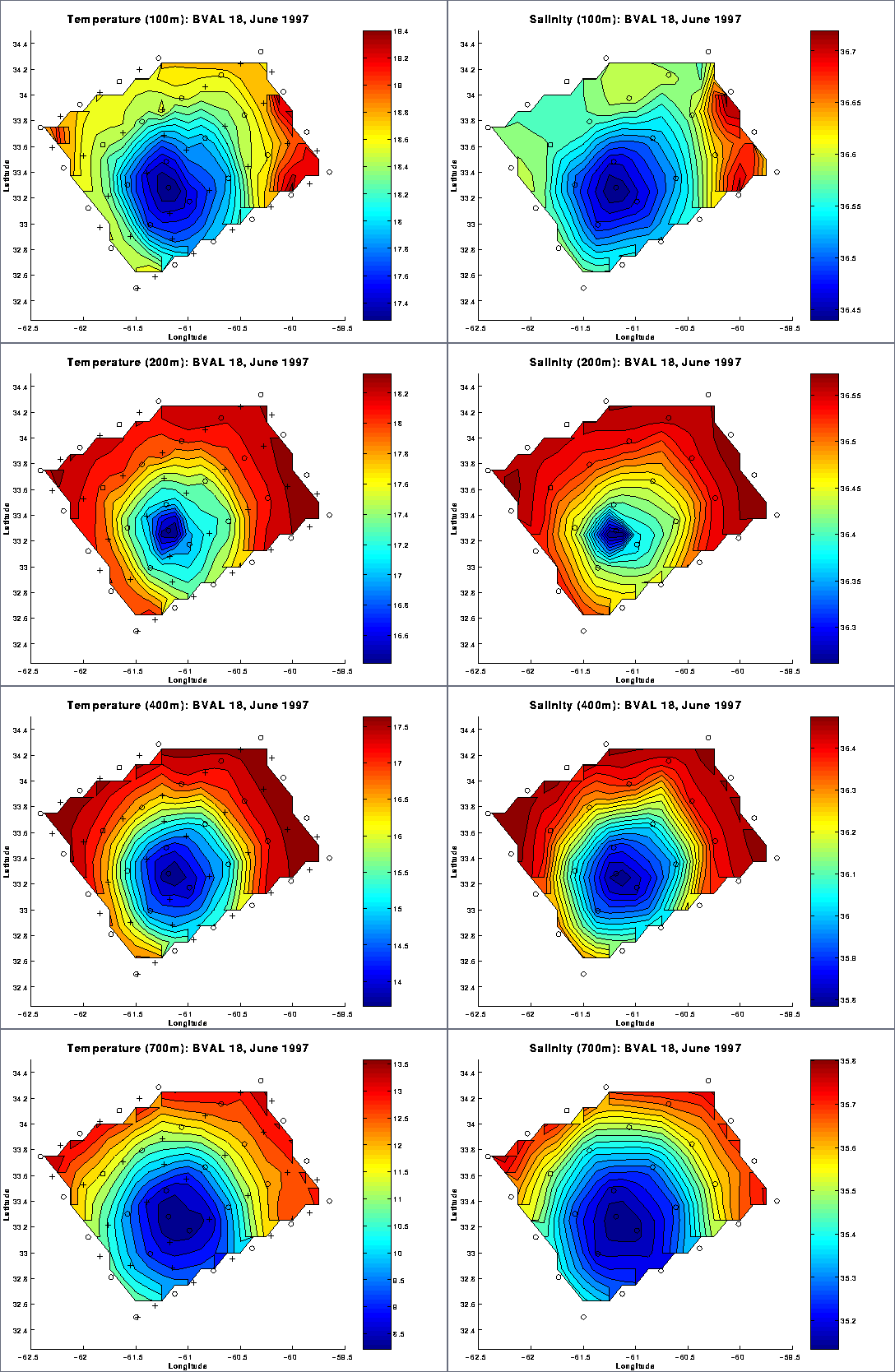
Figure 1. Horizontal maps of temperature and salinity at 100, 200, 400 and 700m. Station locations are indicated by circles (CTD) and crosses (XBT).
Figure 2. Vertical section of temperature along the cruise track. Vertical bars denote endpoints of sampling legs. Note that station numbers are ordered sequentially, both CTD and XBT.
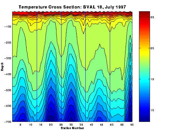
Figure 3. Vertical section of salinity along the cruise track. Vertical bars denote endpoints of sampling legs.
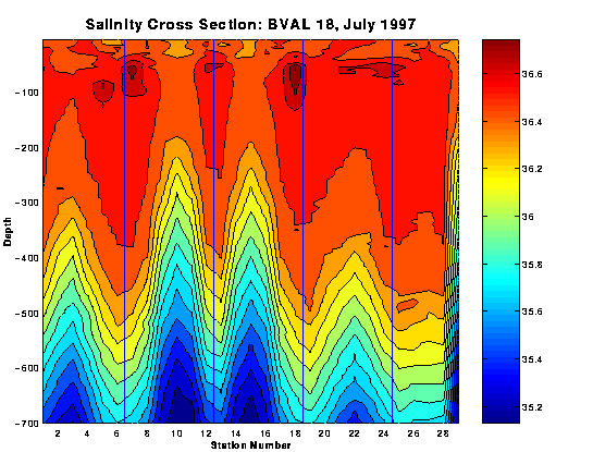
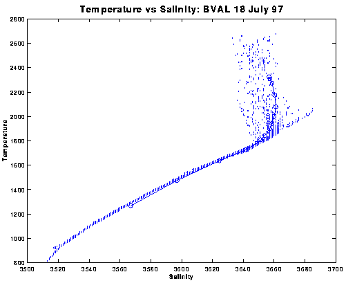
Figure 4. Temperature versus salinity. Climatological mean values indicated by open circles connected with a solid line.